
Business Details
24 Years
experience
Expert Land Surveying & Engineering Services in Reading
Sun Hill Surveying & Engineering has been a trusted name in the land surveying and engineering sector for over two decades. Established in 2002, we combine traditional methodologies with cutting-edge technology to deliver cost-effective, time-efficient solutions tailored to our clients' needs. Our expertise spans diverse environments, including land, waterways, and above- and below-ground structures. With over 20 years of industry experience and 7+ years in mobile mapping, we have completed over 10,000km of topographical surveys, saving clients hundreds of thousands in traffic management costs. Our commitment to innovation is evident in our use of advanced tools such as Leica Pegasus:Two mobile mapping systems, drones, and thermal analysis equipment.We specialise in large-scale infrastructure projects, including highway redesigns, cycleway networks, and rail bridges, ensuring precision and safety in every task. Our web-based platform allows clients to access and analyse vast point clouds remotely, eliminating the need for specialised hardware. We pride ourselves on delivering accurate, reliable data while minimising risks and disruptions to stakeholders. Our team's expertise in confined spaces, ground-penetrating radar, and GIS data capture ensures comprehensive solutions for complex challenges. With a proven track record in the UK construction industry, we remain dedicated to advancing surveying practices through technology and expertise.


Services
Land Topographical Surveys
Mobile Mapping
GIS Data Capture
Drone Inspections
Thermal Analysis
Confined Space Surveys
Traffic Monitoring
Height Clearance Surveys
Progress Surveys
PAS128 Utility Surveys
Details
- Year established: 2002
Highlights and features
- We have over 20 years of experience in land surveying and engineering.
- Our team pioneered mobile mapping solutions across diverse environments.
- We saved clients hundreds of thousands in traffic management costs.
- We deploy advanced technology for above-ground, below-ground, and waterway projects.
- Our web services platform enables remote access to high-resolution survey data.
Services
Land Topographical Surveys
We conduct detailed land topographical surveys using robotic total stations and mobile mapping systems. These surveys produce accurate 2D and 3D models for infrastructure planning and design. Our methods ensure minimal disruption while maintaining high precision for large-scale projects.
Mobile Mapping
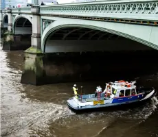
Our mobile mapping services utilise Leica Pegasus:Two systems mounted on vehicles and boats. This technology captures high-resolution data for bridges, highways, and waterways without requiring traffic management, reducing costs and risks for clients.
Drone Inspections
We deploy drones for above-ground inspections of structures like bridges and railways. This approach eliminates the need for working at height, ensuring safety while delivering precise 3D models and progress assessments for construction projects.
Thermal Analysis
Our thermal analysis surveys use specialised cameras to detect water ingress in tunnels and other structures. This non-invasive method identifies issues without disrupting traffic or requiring closures, providing actionable data for maintenance planning.
Confined Space Surveys
We conduct confined space surveys using laser scanners in environments like service tunnels. Our team follows strict safety protocols to deliver accurate 3D models, ensuring minimal risk while meeting project-specific accuracy requirements.
Questions
What surveying technologies does Sun Hill use?
We utilise robotic total stations, Leica Pegasus:Two mobile mapping systems, drones, thermal cameras, and ground-penetrating radar for precise data collection.
How does Sun Hill reduce traffic disruption during surveys?
Our mobile mapping and drone technologies eliminate the need for traffic management, allowing surveys to be completed safely and efficiently without road closures.
Can clients access survey data remotely?
Yes, our web services platform enables clients to view and analyse point clouds and other data remotely via a standard web browser.
What industries benefit from your services?
We primarily support infrastructure and construction projects, including highways, railways, utilities, and urban development across the UK.
How experienced is your team?
Our team has over 20 years of industry experience, with 7+ years specialising in mobile mapping and advanced surveying techniques.