Business Details
17 Years
experience
Your Trusted Land Surveyors in West Wales
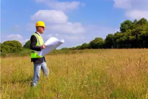
Established in 2009, Torri Tir has built a reputation for delivering precise land surveying and site engineering services across Pembrokeshire, Ceredigion, and Carmarthenshire. Our expertise spans topographical surveys, setting out, GPS and theodolite surveys, and laser hire, supported by over 40 years of industry experience. We utilise cutting-edge technology to ensure accuracy and efficiency, serving both major construction contractors and private clients. Our projects range from multi-million-pound infrastructure developments to smaller localised surveys, with a commitment to value for money and rapid turnaround times.Based in West Wales, we combine local knowledge with global standards, having completed work as far afield as the Falkland Islands. Our teams technical proficiency and dedication to client satisfaction have solidified our position as trusted professionals in the field. We prioritise clear communication and practical solutions, ensuring projects meet exact specifications and regulatory requirements. With a focus on innovation and reliability, Torri Tir continues to adapt to evolving industry demands while maintaining a personal approach to client relationships.
Services
Topographical Surveys
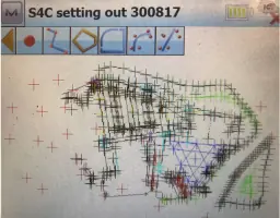
Setting Out
GPS Surveys
Laser Hire
Section 104 & 106
Measured Building Surveys
Monitoring Surveys
TAN 15 Surveys
CAD Services
Sewer Surveys
Details
- Year established: 2009
Highlights and features
- We have over 40 years of experience in land surveying and site engineering.
- Our team utilises the latest GPS and theodolite technology for accurate results.
- We offer competitive pricing for laser hire and surveying equipment.
- Our services cater to both major contractors and private individuals.
- We operate across West Wales and internationally, including the Falkland Islands.
What people say
Excellent service
Results highly recommended
Services
Topographical Surveys
Topographical surveys measure and record surface features to create detailed 3D contoured plans. These maps assist architects and engineers in designing buildings, roads, and structures. Our surveys use GPS and theodolite technology to ensure accuracy, providing clients with reliable data for planning applications and construction projects.
Setting Out
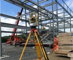
Setting out involves physically marking coordinates on-site using pegs, flags, or spray paint. This process ensures construction aligns with design plans. We use robotic total stations for precision, enabling accurate placement of buildings, roads, and infrastructure according to architectural specifications.
GPS Surveys
GPS surveys utilise satellite technology for high-accuracy positioning. This method is ideal for large-scale projects requiring Ordnance Survey datum compliance. We combine GPS with traditional theodolite techniques to overcome signal limitations, ensuring comprehensive data collection for complex terrains.
Laser Hire
We offer competitive laser hire for construction projects, including rotating, dual-grade, and pipe lasers. These tools ensure level foundations, accurate grading, and precise pipe installation. Our equipment supports applications from floor slabs to sports pitches, with technical support available for optimal use.
Section 104 & 106
We manage Section 104 and 106 agreements for water authority approvals. Our services include design, setting out, and documentation to meet regulatory standards. This ensures infrastructure projects comply with drainage and utility requirements, facilitating smooth approvals and construction processes.
People
Manvil Phillips
Founder & Lead Surveyor
Manvil Phillips, a Pembrokeshire native with over 40 years of experience, founded Torri Tir after serving in the Royal Engineers. His expertise spans land surveying and site engineering, working with major contractors and private clients across the UK and internationally.
Questions
What areas do Torri Tir cover?
We primarily operate in Pembrokeshire, Ceredigion, and Carmarthenshire, with international experience including the Falkland Islands.
What surveying technologies do you use?
We utilise GPS real-time surveys, robotic total stations, and advanced laser technology for precise data collection.
Can you assist with construction laser hire?
Yes, we offer competitive hire rates for rotating, dual-grade, and pipe lasers suitable for various construction needs.
Do you work with private individuals as well as contractors?
Yes, we provide services to both private clients and major construction firms, tailoring solutions to project scale.
How long has Torri Tir been in business?
We have been operating as a limited company since 2009, with over 19 years of combined industry experience.